


The guys at Ubipix came to Magma to help figure out how to communicate what their software does. First, we had to understand how it worked ourselves.
WHAT IS UBIPIX?
UNDERSTANDING THE TECH
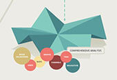
Ubipix is a platform that brings together video, navigation and data. You can gather GPS video, or footage from specialist tools such as an underwater ROV or a quadcopter, and collate everything in Ubipix to turn your raw data into a cloud-hosted overview of your subject. Measure distances, tag objects and perform spatial queries, then turn it into useful graphs that you can now share within a private, secure team.


ISOMETRIC ILLUSTRATIONS
3D, BUT WITHOUT THE GLASSES
We decided to create tiny worlds, showing how the service could be used in various geographic locations, and by various industries, all in one concise illustration. We wanted the world to be three-dimensional, and an isometric style suited the technical, data driven nature of the software. It also gave us some visual constraints to help tie together some complex objects in a consistent style.


UBIPIX MOBILE APP
POCKET-SIZED GPS VIDEO
We also created an app that brings many of the features of UbiPix together on your mobile device, including the GPS video feature. Read more about the UbiPix app here.